Partners


European Neighborhood Policy And Enlargement Negotiations
Partnership for addressing common challenges related to improve well-being of the people through Cross Border Corporation in the Black Sea Region.
We have created the Consortium represented by BSB countries: Georgia, Romania, Turkey, Bulgaria
to submit the joint proposal to BSB CBC 1st Call 2014-2020
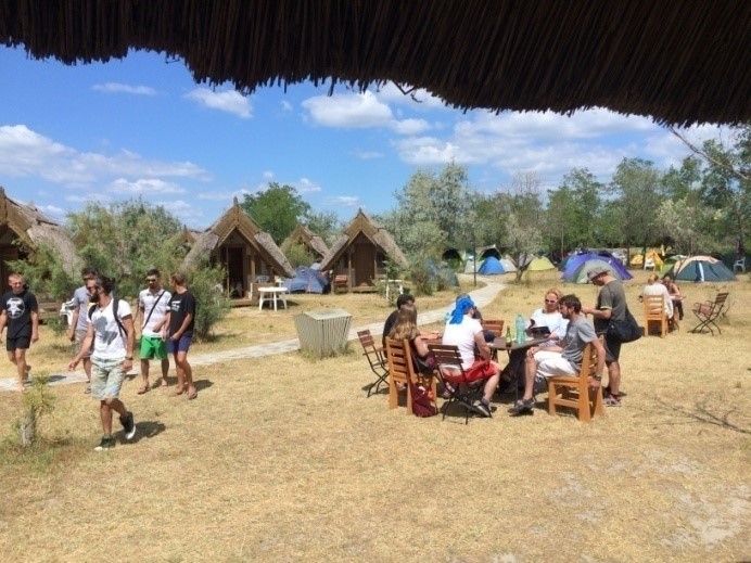
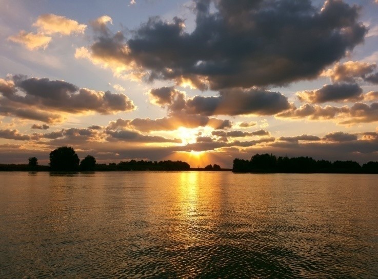
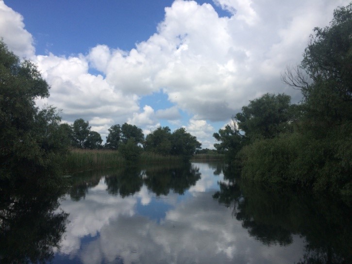
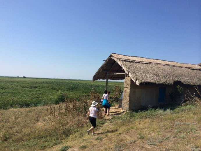
Here you are the main places where the joint Action is supposed to be implemented
Who we are?
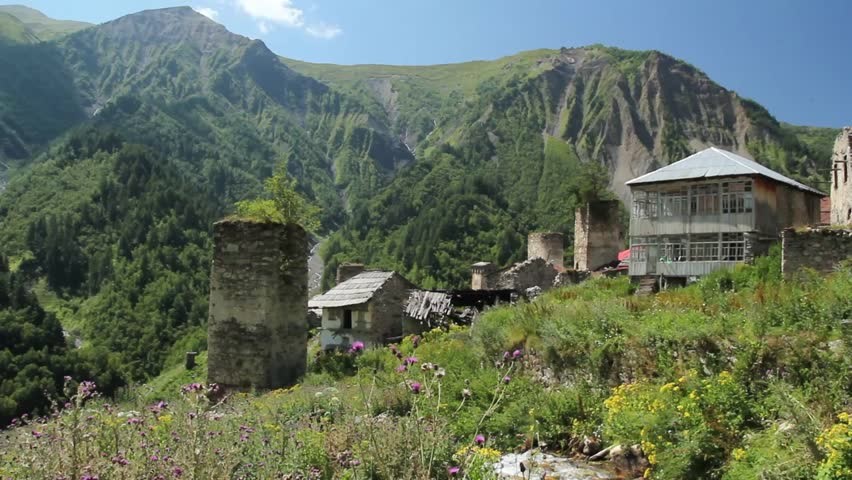
From Georgia
Organization:
International Center for Caucasus Tourism, NGO Tbilisi
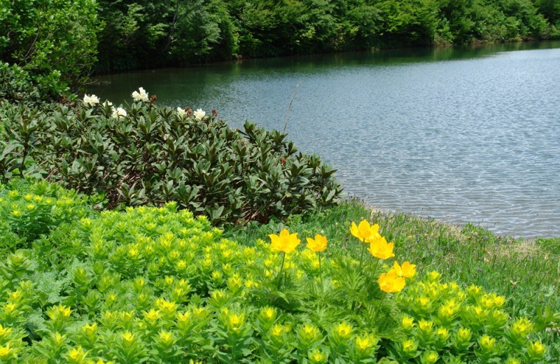
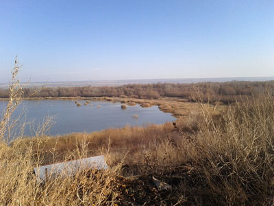
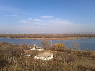
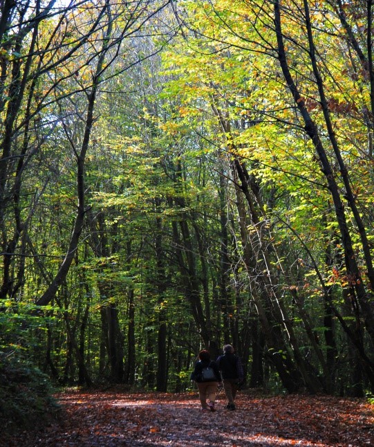
The Kintrishi Protected Landscape is a protected landscape in Kobuleti District, Adjara, Georgia, located at the gorge of the Kintrishi River and was established in 1959 to preserve its unique flora and fauna and famous Colchian willow trees. Archeological excavations revealed even older pre-Christian monuments in the areas.
The Kintrishi State Nature Reserve covers 18,893 hectares (46,690 acres).
Kintrishi Protected Area is located in Adjara Autonomous Republic (Kobuleti Municipality) between the Black Sea coast and the mountains of Adjara Region with a total area of 13,893 ha. It is located in picturesque valley of the river Kintrishi, between village Tskhemvani and Khino Mountains, at an altitude of 2,800 meters above sea level. Protected area is bordered with Kobuleti forest administration from the north, Shuakhevi municipality area from the east, Keda municipality from the south and Mtirala National Park from south-west.
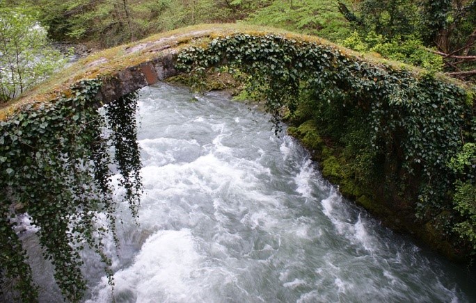
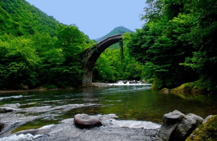
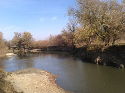
An arched 12th-century bridge over the Kintrishi
Kintrishi Protected Areas Administration manages two different types of protected areas – State Nature Reserve and Protected Landscape. Kintrishi State Nature Reserve was established in 1959 and its purpose is to protect relict forest and endemic species, flora and fauna of Shuamta.
From Romania
Organizations:
1. Association for Sustainable Development Prut Danube Galati
Romania, Galati county has declared a number of 17 protected areas of national interest including 16 nature reserves declared under Law no. 5/2000 on national territory, Section III, and 1 protected natural park areas, based on the Government Decision no. 2151/2004 regarding the creation of the protected area to new areas.
|
No.
|
NAME
|
Law
|
Protected area
Category
|
Area/(ha)
|
|
1
|
Hanu Conachi Sand Dune
|
Legea 5/2000
|
Natural Reservation
|
199,30
|
|
2
|
Potcoava Pool
|
Legea 5/2000
|
Natural Reservation - Wetland
|
49,00
|
|
3
|
Tălăbasca Pool
|
Legea 5/2000
|
Natural Reservation - Wetland
|
139,00
|
|
4
|
Gârboavele Forest
|
Legea 5/2000
|
Natural Reservation
|
230,00
|
|
5
|
Pogăneşti Forest
|
Legea 5/2000
|
Natural Reservation
|
33,50
|
|
6
|
Breana - Roşcani Forest
|
Legea 5/2000
|
Natural Reservation
|
78,30
|
|
7
|
Buciumeni Forest
|
Legea 5/2000
|
Natural Reservation
|
71,20
|
|
8
|
Pochina Pool
|
Legea 5/2000
|
Natural Reservation - Wetland
|
74,80
|
|
9
|
Vlăşcuta Lake
|
Legea 5/2000
|
Natural Reservation - Wetland
|
41,80
|
|
10
|
Prut Lower Meadow
|
Legea 5/2000
|
Natural Reservation - Wetland
|
81,00
|
|
11
|
Prut Island
|
Legea 5/2000
|
Natural Reservation - Wetland
|
62,00
|
|
12
|
Tirighina Barboşi Fosil Place
|
Legea 5/2000
|
Paleontological Natural Reservation
|
1,00
|
|
13
|
Rateş Fosil Place
|
Legea 5/2000
|
Paleontological Natural Reservation
|
1,50
|
|
14
|
Fundeanu Forest
|
Legea 5/2000
|
Natural Reservation
|
53,20
|
|
15
|
Tălăşmani Forest
|
Legea 5/2000
|
Natural Reservation
|
20,00
|
|
15
|
Bereşti Fosil Place
|
Legea 5/2000
|
Paleontological Natural Reservation
|
49,00
|
|
17
|
Natural Park Lower Prut Floodplain
|
HG 2151/2004
|
Natural Park
|
8247,00
|
2. Danube Delta National Institute for Research and Development
"At the end of the 2840 km that it crosses from its springs, from the Black Forest Mountains, Germany to Pontus Euripus (The Black Sea), Danube has been giving birth, for more than 12.000 years, to one of the most representative and magnificent deltas of Europe and even the world."1
Danube Delta (DD), covering an area of 5800 km2, is a cross border territory, spreading 80% in Romania and 20% in Ukraine, structured by the three branches of the Danube (Chilia, Sulina and Sfantu Gheorghe).
The alternance of water and land in the particular DD landscape offers good conditions for a large number of species of plants and animals. It encompasses one of the largest compact reed surfaces in the world and Letea and Caraorman forests represent the northern limit for two rare species of oak, encountered more frequently in the southern areas of the Balkan and Italic Peninsulas.
It is well known for the impressive pelican and cormorants colonies and many other birds that can be seen here and for the great variety of fish, with an important ecological and economical value. These characteristics are the arguments that lead the Romanian Government to declare Danube Delta in 1990 a Biosphere Reserve, decision confirmed by the Parliament in 1993.
The universal value of DD was acknowledged by its inclusion, in 1993, in the international network of Biosphere Reserves through UNESCO’s “Man and Biosphere” Programme, therefore today, the Danube Delta is today on the UNESCO’s World Heritage Site’s list, for its inestimable natural patrimony. Since 1991, Danube Delta is also listed as a RAMSAR site (wetland of international importance, especially as a habitat of aquatic birds). Not to mention that almost all its territory is part of Natura 2000 sites.
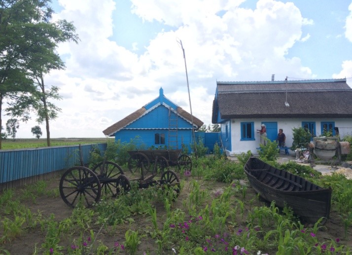
This unique area is also the place in which the man belonging to the traditional communities has moulded his habitat. Danube Delta is almost entirely a rural area. Besides from the ethnical diversity, the specific geographical configuration of the Delta has led to an unusual joining of forms, materials and textures, a mixture that resulted in settlements with a strong sense of local specificity and to an architecture that draws its roots deep into the site’s topography. Since there are strong russian lipovans and ucrainean ethnical communities, you will frequently meet houses painted with bright shades of blue, green and red (typical for Russian architecture).
As a conclusion, given the multiple protection status of the area, the strong local specificity and taking into account the rural communities need for development, initiatives that bring to the local population new alternatives for income generating activities, without harming the environment are a required course of action.
From Turkey
Organization:
Istanbul 1 st Regional Directorate Ministry of Forestry and Water Affairs
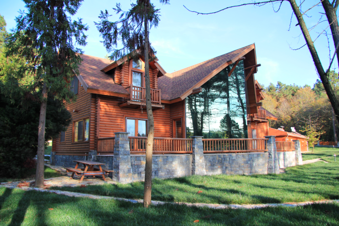
The Protected Area is Polonozköy Nature Park in the Anatolian side of Istanbul within Beykoz District, of which the majority of the park is a part of a forest. Around the park there is a housing district namely Polonezköy, which was establish by Polish migrants. The south of the Natural Park is a settlement area with housing, villa greenhouse, water storage house, barn etc. Therefore, necessary infrastructure is available for the subject project. Polonezköy Nature Park is affiliated to the First Regional İstanbul Directorate of the General Directorate of Nature Conservation and National Parks of Turkey at the Ministry of Forestry and Water Affairs.
From Bulgaria
Organization:
Municipality Malko Tarnovo, Burgas District
Associated Partner Organization: Regional Development and Territorial Planning
Regional Government Of Burgas
Malko Tarnovo
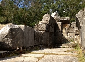
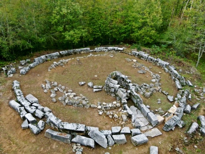
It was discovered in 1981-83g. Located in the area. Mishkova levels (Buchvarova hut) on the southeastern slope of the Great site, about 3 km southwest of Malko Tarnovo, close to the state border with Turkey. Too close is to this type of meters. Propada, but is much larger and more impressive. The sanctuary is part of a large complex consisting of a fortress atop Big Gradiste, mines at the foot of his necropolis, fortified buildings and urban ruins.
The vegetation of Strandja is the most prominent representative of the Euxinian Botanico-geographical Province, which extends solely to the Bulgarian Black Sea coast in Europe. Strandja forests include ancient remnants of the deciduous hygrophyte tertiary vegetation of Europe, with laurel undergrowth of evergreen shrubs, which is characteristic of the forests of the South Caucasus and the coast of Asia Minor. This ancient plant community is called southeuxinian (from Greek. -"EuxinianPont" - BlackSea) or Colchic (named after the mythical Colchis valley in Georgia, Caucasus) and is spread on the territories of Strandja, northern Turkey, Caucasus and northwestern Iran.
The Strandja Nature Park was designated in 1995 and is Bulgaria’s largest protected area.
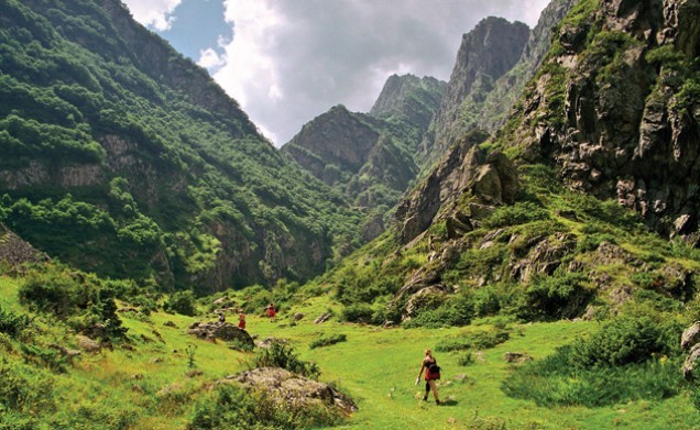
Covers an area of 1,161 sq.km – 1% of the country’s territory. The nature park occupies the central part of Bulgarian Strandja reaching the Black Sea Coastline. The park is approximately 50 km long from east to west and 25 km wide, on average, from north to south. There are 5 nature reserves in the park, 14 protected areas and 8 nature landmarks. Approximately 830 km of marked hiking routes lead the visitors into the park. These trails are of different types and degrees of difficulty. Information boards tell about the amazing animal and plantspecies inhabiting the park.
web: http://www.malkotarnovo.org/
http://www.strandja.bg/
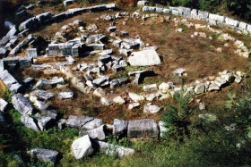
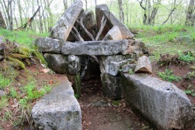
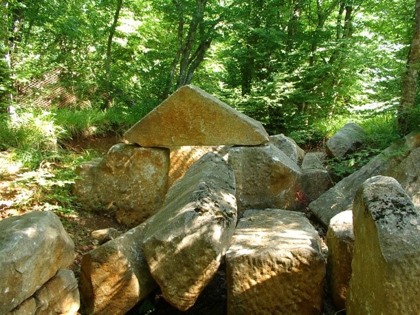
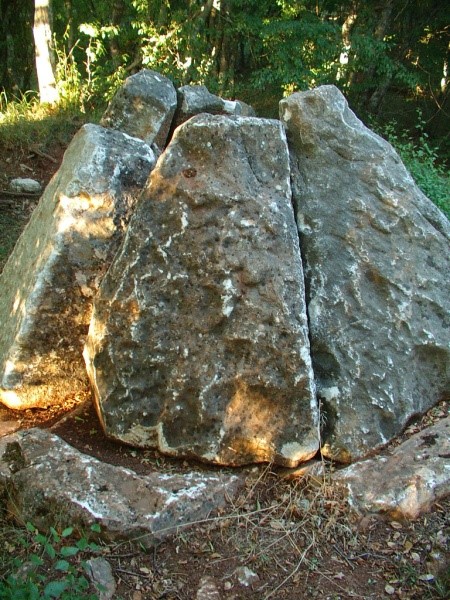
THRACIAN CULT COMPLEX IN LOCALITY "PROPADA", NEAR MALKO TARNOVO
The area "Propada" is located in the forest, 3 km northwest of the town of Malko Tarnovo.
HISTORY
Unique religious facility from the 1st-4th century, connected with the worship of the Sun God and Mother Goddess, and the cult to ancestors. At its center was built a beehive tomb, which is situated in the southern part of a wide circle made of large stones with a diameter of 23 m and 1.8 m height. Around 150 meters away, there is a large necropolis and fortified villa of the same period.
The cult complex consists of 48 Thracian burial mounds, in which were found cist burials and six stone tombs dated between the 4th - 1st century BC.
It is located on 3 km southwest of town, at the foot of the hill, where the ancient fort "Golyamo Gradishte" was once built.
PRESERVATION
Condition: The sanctuary has been studied by archaeologists and is partially reinforced. There is a marked trail for tourists. The archaeological survey has been carried out; there is partial reinforcement of the stones.
AREA DESCRIPTIONS
Public access: Asphalt road until the end of the city and then forest path that climbs up the high hill, covered with oak forest. The tourist trail is marked with info boards. 3 km along E87 from the town of Malko Tarnovo - direction border crossing "Malko Tarnovo" for Turkey and 1 km forest path to the sanctuary.
We hope:
-
Created proposal be competitive via synergic efforts and potential capabilities of the partners.
-
Application be awarded
-
Project be successfully implemented